3D print Saint Olav's Church, Kirkjubøur
A free, printable model of Saint Olav's Church, Kirkjubøur, a long gabled church with a small roof turret, with the headland, paths and water around it, generated from real map data in your browser.
-
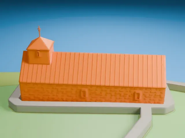 North
-
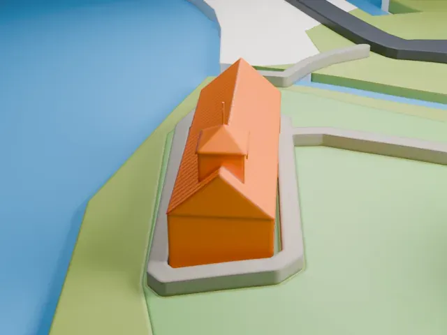 East
-
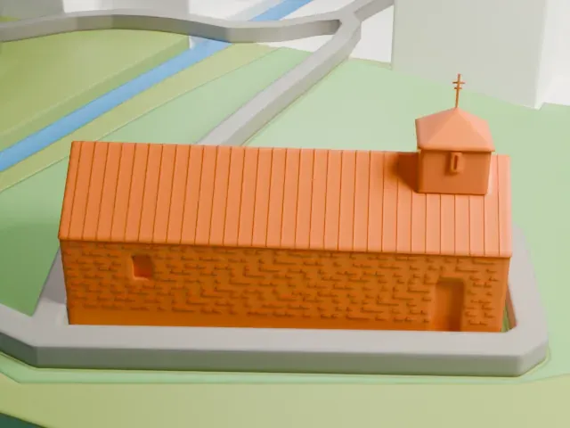 South
-
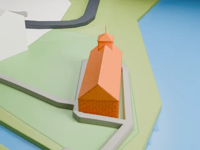 West
The model you print
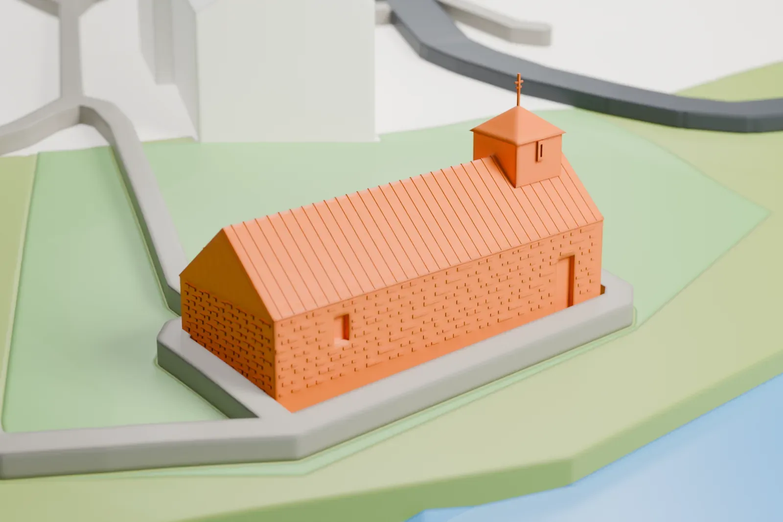
Saint Olav's Church, Kirkjubøur in 3D
The landmark on its own, at its size on a 160 mm print. Print friendly thickens thin parts for a 0.4 mm nozzle; Full detail keeps every part.
- On a 160 mm print
- 4 mm
- Scale
- 1:3,750
4 mm tall on a 160 mm print
Make this print opens the generator on a 600 m square around the landmark. Buildings print at close to true scale, so the landmark grows with the print size.
- Stonework and roof texture
The walls and roof carry fine surface texture. A layer height of 0.12–0.16 mm and a bigger print size keep it readable; Full detail keeps all of it.
- Small turret and thin cross
A small roof turret carries a thin cross. Print friendly adapts the cross to the print scale; Full detail keeps it on a larger print, ideally printed slowly.
- One piece with the ground
Saint Olav's Church, Kirkjubøur is joined to the ground in the exported file, and the four-side check found no floating parts, so nothing needs gluing.
- Pick the detail for your nozzle
In the Buildings settings, set Landmark detail to Print friendly to adapt thin parts and small details to the print scale. Full detail keeps every modeled feature, for larger prints or a finer nozzle.
- Colors
Buildings, roads, water and ground arrive as separate filament slots in the 3MF. Saint Olav's Church, Kirkjubøur takes the building color.
- File format
You get a 3MF for Bambu Studio, OrcaSlicer or PrusaSlicer. Any of them can save it as STL if you need one.
About Saint Olav's Church, Kirkjubøur
Saint Olav's Church (Ólavskirkjan in Faroese) stands in the village of Kirkjubøur on Streymoy, in the Faroe Islands. Dating from before 1200, it is the oldest church in the Faroe Islands. Up to the Reformation, the Catholic bishop for the Faroe Islands had his seat there.
The church's 15th-century pew ends were transferred in 1875, after a restoration, to Copenhagen, where the National Museum of Denmark received them. In 2002 they came back and went on show at the Faroe Islands' National Museum, where they rank among its most valued cultural items. There are 14 pew ends: 11 depict the Apostles and the other three show further Biblical figures. They appeared on postal stamps in 1980, 1984 and 2001.
The Kirkjubøur stone, a runestone, turned up in the church in 1832 and is kept in the Faroe Islands' National Museum. The church is built of fieldstone, measures 21.8 m long and 7.5 m wide, and is named after Olaf II of Norway.
About this model
Saint Olav's Church, Kirkjubøur is one of more than 6,500 landmark models in Mini Skyline. They are made with AI, and each one is checked in its real surroundings before release. Each model is written as code from public descriptions, plans, photographs and aerial views used only as references; no image or third-party model is copied into it. Everything around it is built from OpenStreetMap and Overture map data. Rights in the building itself, its name and any brands on it are not granted by Mini Skyline; clear them separately before you sell prints. If you would rather print the shape from map data, turn off Landmark models in the Buildings settings.
Mini Skyline is not affiliated with, or endorsed by, the owners of this building or its names and marks.
Same skyline