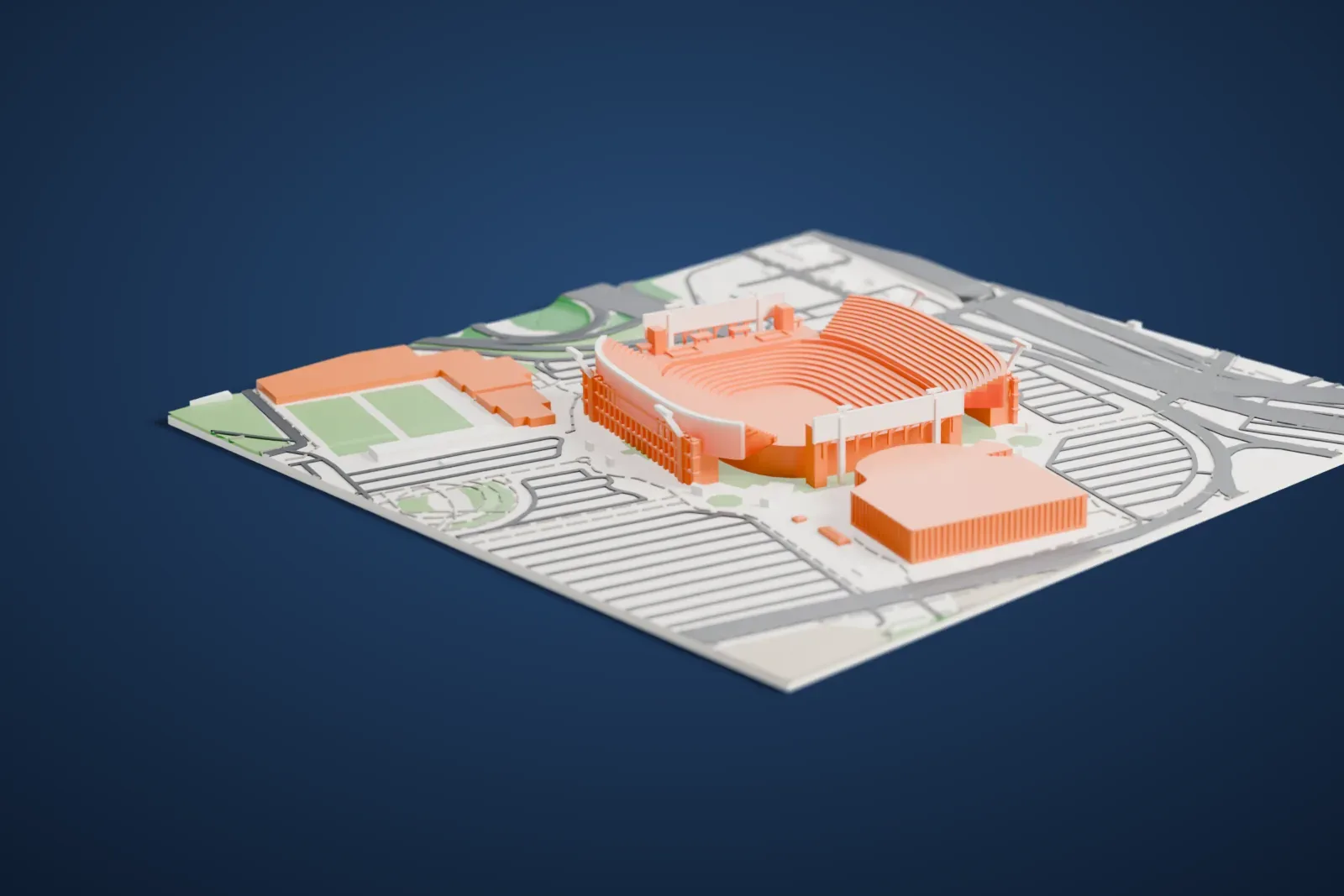
EverBank Stadium in 3D
EverBank Stadium appears in city models you make here; its design may still be protected, so it isn't offered as a separate download.
-
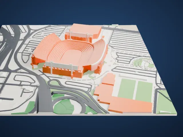 North
-
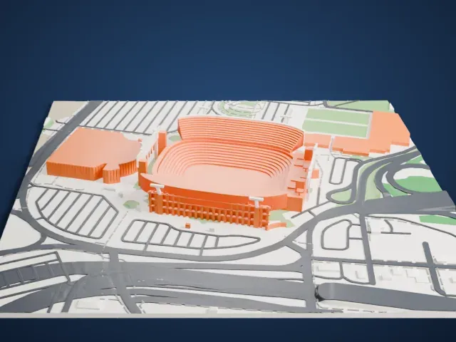 East
-
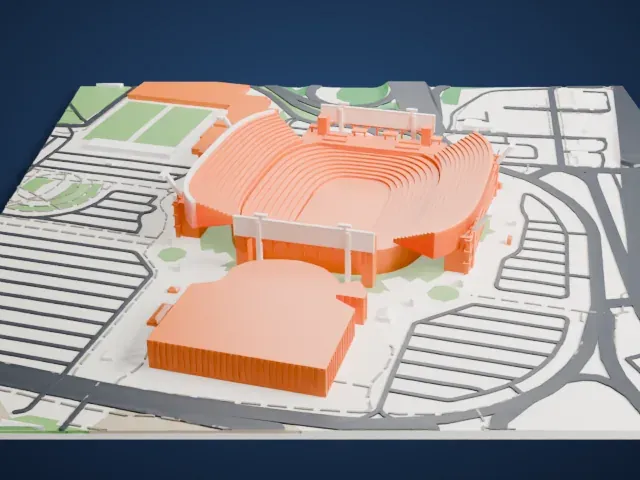 South
-
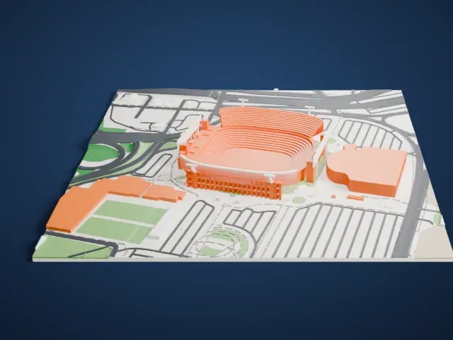 West
Copyright notice
The design of EverBank Stadium may still be protected by copyright. It appears in the city models you make here, but it is not offered as a separate model.
- On a 160 mm print
- 14 mm
- Scale
- 1:4,063
14 mm tall on a 160 mm print
Make this print opens the generator on a 650 m square around the landmark. Buildings print at close to true scale, so the landmark grows with the print size.
- A stack of narrow seating tiers
The bowl is built from many thin, curving rows of seating. A bigger print keeps them as separate steps, and Print friendly adapts them to the print scale when the model is small.
- Slim poles around the rim
Thin poles and frames stand at the corners and ends of the bowl. Printing slowly and using layers of 0.12 to 0.16 mm helps keep them clean.
- One piece with the ground
EverBank Stadium is joined to the ground in the exported file, and the four-side check found no floating parts, so nothing needs gluing.
- Pick the detail for your nozzle
In the Buildings settings, set Landmark detail to Print friendly to adapt thin parts and small details to the print scale. Full detail keeps every modeled feature, for larger prints or a finer nozzle.
- Colors
Buildings, roads, water and ground arrive as separate filament slots in the 3MF. EverBank Stadium takes the building color.
- File format
You get a 3MF for Bambu Studio, OrcaSlicer or PrusaSlicer. Any of them can save it as STL if you need one.
About EverBank Stadium
EverBank Stadium is a football venue in Jacksonville, Florida, and the home field of the NFL's Jacksonville Jaguars. It sits beside the St. Johns River in downtown Jacksonville's Stadium District, an area where football fields have stood since early in the 20th century. The site covers 4.0 ha (10 acres). In 1995 it opened under the name Jacksonville Municipal Stadium, built where the older Gator Bowl Stadium had stood.
The new building reused some parts of the old one, namely its pedestrian ramp system and the West Upper Deck. Work began on January 3, 1994, and the first event was an exhibition game against the St. Louis Rams on August 18, 1995. Construction lasted less than 20 months in all.
The annual Florida–Georgia game, a college football rivalry between the University of Florida's Gators and the University of Georgia's Bulldogs, is regularly played here, and the annual Gator Bowl, a postseason game between college teams, is also played here. Super Bowl XXXIX was held here in 2005 and ended in a 24–21 win for the New England Patriots over the Philadelphia Eagles, with 78,125 in attendance. The stadium also serves for concerts and other events, and the U.S. men's national soccer team has used it as a venue.
About this model
EverBank Stadium is one of more than 5,500 landmark models in Mini Skyline. They are made with AI, and each one is checked in its real surroundings before release. Each model is written as code from public descriptions, plans, photographs and aerial views used only as references; no image or third-party model is copied into it. Everything around it is built from OpenStreetMap and Overture map data. Rights in the building itself, its name and any brands on it are not granted by Mini Skyline; clear them separately before you sell prints. If you would rather print the shape from map data, turn off Landmark models in the Buildings settings.
Mini Skyline is not affiliated with, or endorsed by, the owners of this building or its names and marks.
Keep exploring