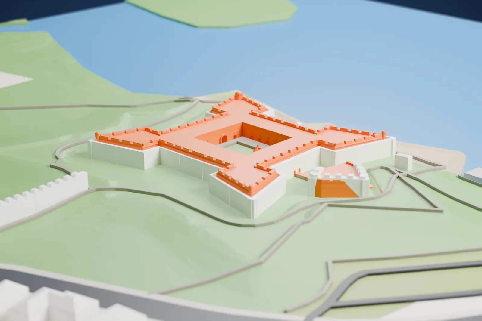
3D print Castillo de San Marcos
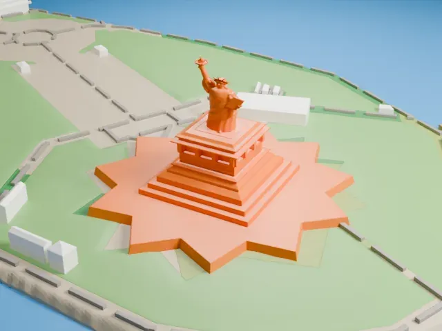
A free, printable model of Castillo de San Marcos, a star-shaped fort on the shore beside the bay, generated from real map data in your browser.
-
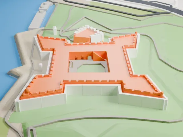 North
-
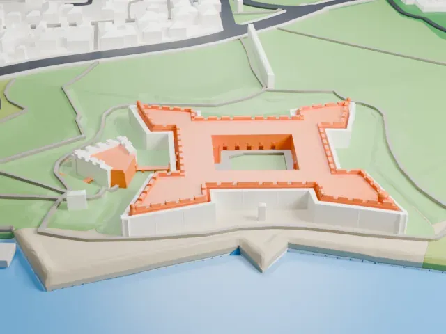 East
-
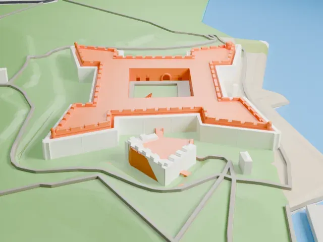 South
-
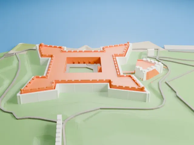 West
The model you print
Castillo de San Marcos in 3D
The landmark on its own, at its size on a 160 mm print. Print friendly thickens thin parts for a 0.4 mm nozzle; Full detail keeps every part.
- On a 160 mm print
- 4 mm
- Scale
- 1:3,750
4 mm tall on a 160 mm print
Make this print opens the generator on a 600 m square around the landmark. Buildings print at close to true scale, so the landmark grows with the print size.
- Crenellated parapets and turrets
The walls carry small battlements and corner turrets. Print friendly adapts these small details to the print scale; Full detail keeps them, best on a larger print with 0.12–0.16 mm layers.
- One piece with the ground
Castillo de San Marcos is joined to the ground in the exported file, and the four-side check found no floating parts, so nothing needs gluing.
- Pick the detail for your nozzle
In the Buildings settings, set Landmark detail to Print friendly to adapt thin parts and small details to the print scale. Full detail keeps every modeled feature, for larger prints or a finer nozzle.
- Colors
Buildings, roads, water and ground arrive as separate filament slots in the 3MF. Castillo de San Marcos takes the building color.
- File format
You get a 3MF for Bambu Studio, OrcaSlicer or PrusaSlicer. Any of them can save it as STL if you need one.
About Castillo de San Marcos
The Castillo de San Marcos is the oldest masonry fort anywhere in the continental US. It sits beside Matanzas Bay, on the water's western edge, in St. Augustine, Florida. The Spanish engineer Ignacio Daza designed it, and building began in 1672. Governor Francisco de la Guerra ordered it after the English privateer Robert Searles raided in 1668, destroying much of St. Augustine and damaging the existing wooden fort. The heart of today's fortress was finished in 1695.
The fort is built of coquina, a sedimentary rock formed from ancient shells that bonded together and that resembles limestone. Native Americans from nearby Spanish missions carried out most of the labor, and skilled workers came from Havana, Cuba. It has a star-shaped plan with four bastions, called San Pedro, San Agustín, San Carlos, plus San Pablo, a ravelin protecting the sally port, and a large glacis on the two landward sides.
Possession of the fort changed five times, all peacefully, among four different governments. It came under attack several times and was besieged twice, in 1702 and 1740, yet owing to its cannon placement and star-shaped design no enemy ever breached it or took it by force. Its National Monument status dates to 1924. It was deactivated in 1933 following 251 years under continuous military control, and then passed to the National Park Service.
About this model
Castillo de San Marcos is one of more than 6,500 landmark models in Mini Skyline. They are made with AI, and each one is checked in its real surroundings before release. Each model is written as code from public descriptions, plans, photographs and aerial views used only as references; no image or third-party model is copied into it. Everything around it is built from OpenStreetMap and Overture map data. Rights in the building itself, its name and any brands on it are not granted by Mini Skyline; clear them separately before you sell prints. If you would rather print the shape from map data, turn off Landmark models in the Buildings settings.
Mini Skyline is not affiliated with, or endorsed by, the owners of this building or its names and marks.
Keep exploring