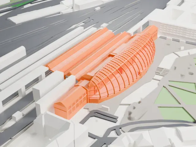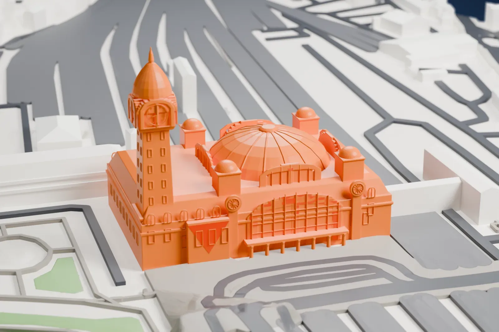
Limoges-Bénédictins station in 3D
Limoges-Bénédictins station appears in city models you make here; its design may still be protected, so it isn't offered as a separate download.
-
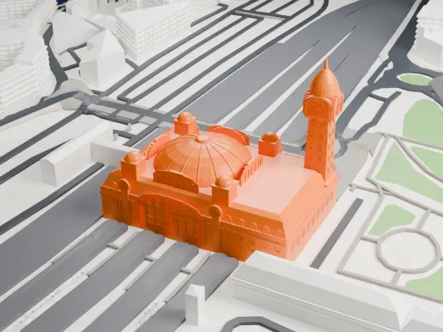 North
-
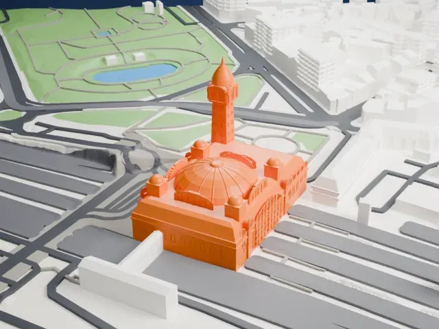 East
-
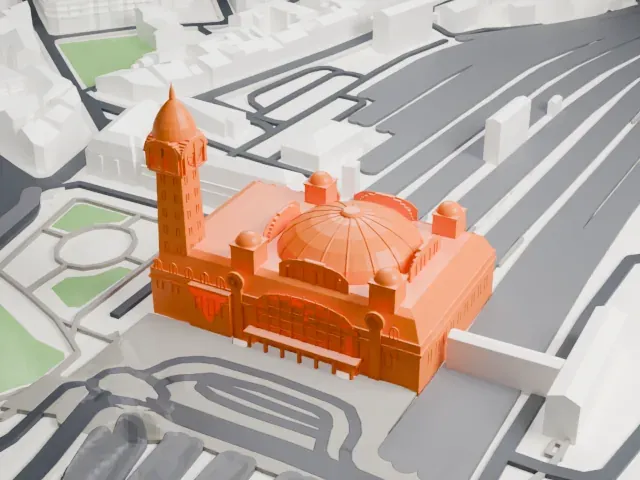 South
-
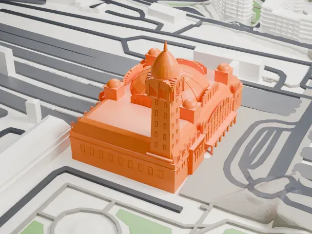 West
Copyright notice
The design of Limoges-Bénédictins station may still be protected by copyright. It appears in the city models you make here, but it is not offered as a separate model.
- Real height
- 67 m
- On a 160 mm print
- 18 mm
- Scale
- 1:3,750
67 m of Limoges-Bénédictins station, 18 mm on your shelf
Make this print opens the generator on a 600 m square around the landmark. Buildings print at close to true scale, so the landmark grows with the print size.
- Clock tower and ribbed dome
The tall clock tower with its vase finial and the ribbed dome with small cupolas are the delicate parts. Print slowly with cooling, use a 0.12–0.16 mm layer height, and try Full detail on a larger print.
- One piece with the ground
Limoges-Bénédictins station is joined to the ground in the exported file, and the four-side check found no floating parts, so nothing needs gluing.
- Pick the detail for your nozzle
In the Buildings settings, set Landmark detail to Print friendly to adapt thin parts and small details to the print scale. Full detail keeps every modeled feature, for larger prints or a finer nozzle.
- Colors
Buildings, roads, water and ground arrive as separate filament slots in the 3MF. Limoges-Bénédictins station takes the building color.
- File format
You get a 3MF for Bambu Studio, OrcaSlicer or PrusaSlicer. Any of them can save it as STL if you need one.
About Limoges-Bénédictins station
Limoges's main railway station is Limoges-Bénédictins, on the Orléans–Montauban railway. It takes its name from a Benedictine monastery that was closed during the French Revolution. The first station, made of wood, opened on June 16, 1856, and the first stone station followed in 1860. The city council and the CF du PO signed an agreement for a new station on November 21, 1918, construction ran from 1924 to 1929, and the station was inaugurated on July 2, 1929.
Roger Gonthier designed the station, and it was built over its ten railway lines instead of beside them, on a platform measuring 90 by 78 meters. Its frame is concrete, with limestone filling, and the dome over the passenger concourse is a metal frame clad in copper. On the southwest corner stands a clock tower 67 meters (220 ft) tall with thirteen levels, topped by a dome that carries a vase 5 meters (16 ft) tall. Four clocks, each 4 meters (13 ft) wide, sit below.
It received monument historique listing on January 15, 1975, and restoration of the Great Hall was finished in 1979. A fire broke out under the dome on February 5, 1998. The city was deeply affected, and the dome was rebuilt as it had first been designed.
About this model
Limoges-Bénédictins station is one of more than 6,500 landmark models in Mini Skyline. They are made with AI, and each one is checked in its real surroundings before release. Each model is written as code from public descriptions, plans, photographs and aerial views used only as references; no image or third-party model is copied into it. Everything around it is built from OpenStreetMap and Overture map data. Rights in the building itself, its name and any brands on it are not granted by Mini Skyline; clear them separately before you sell prints. If you would rather print the shape from map data, turn off Landmark models in the Buildings settings.
Mini Skyline is not affiliated with, or endorsed by, the owners of this building or its names and marks.
Keep exploring